
Business
First Alert Forecast: Dry, warm weather this week before cold blast arrives Friday
By Cynthia Blake
Advertisement · Why this ad?
Cynthia holds an MBA from Georgia State University and has over 7 years of experience covering business news for local papers like the Atlanta Business Chronicle. Her expertise lies in local entrepreneurship and economic development, focusing on how businesses adapt in a changing market.
More from Cynthia →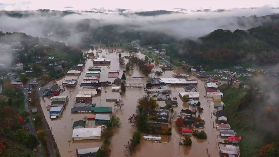
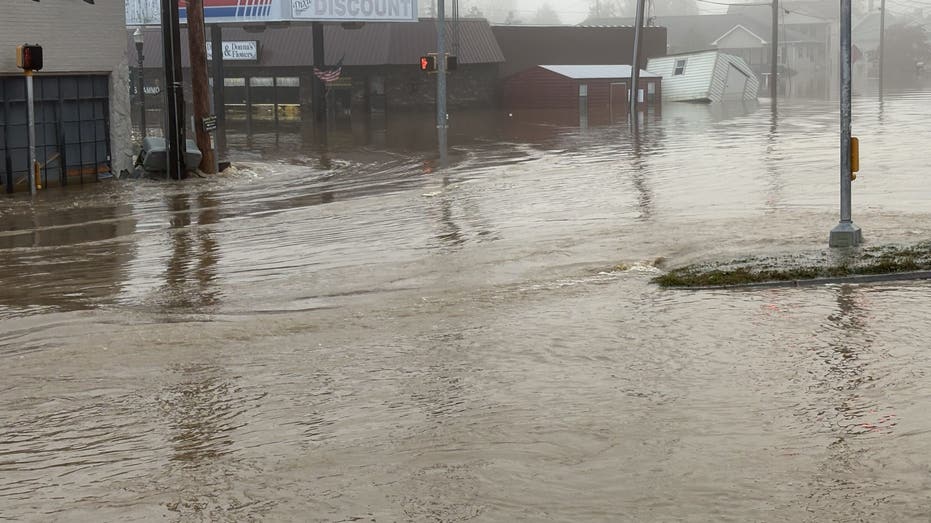
The Brief Ellijay narrowly avoided catastrophic North Georgia flooding after extreme rainfall fell just miles outside it's river basin. Rainfall exceeding 11 inches fell below the Blue Ridge Dam, sending uncontrolled runoff into the Toccoa River and Fightingtown Creek. A slight southward shift would have dumped 36 billion gallons of water directly into rivers converging on downtown Ellijay. A historic North Georgia deluge set record water levels in McCaysville, but natural mountain divides spared neighboring Ellijay from catastrophic downtown destruction. McCaysville flood runoff path Why you should care: Historic floodwaters tore through McCaysville, yet geographic boundaries prevented the deluge from reaching its worst possible outcome. Runoff poured directly into the lower Toccoa River and Fightingtown Creek because no reservoir sits downstream of the Blue Ridge Dam to slow the surge. Blue Ridge rainfall totals By the numbers: Blue Ridge recorded 11.19 inches of rain, while gauges elsewhere in Fannin County measured 9.08 inches and 7.57 inches. Further south toward Mountaintown, rainfall reached 6.8 inches on the opposite side of the mountain ridge. Watershed divide protects communities The backstory: Heavy rain south of the watershed divide drained toward Ellijay instead of flowing north into McCaysville. If the storm track had shifted five to 10 miles north, an additional eight to 11 inches of rain would have pushed the Toccoa River far beyond newly set records. Mountain rivers threaten Ellijay Local perspective: Downtown Ellijay escaped the heaviest rain bands, dodging what could have been a catastrophic double-river surge. The Ellijay River flows south while the Cartecay River approaches from the east, converging near the heart of the city to form the Coosawattee River without any large flood-control reservoirs upstream. National Weather Service warnings Big picture view: Shifting the storm core 10 to 15 miles south would have dumped roughly 36 billion gallons of water across local river basins, calculated at roughly 17.4 million gallons per inch of rain over each square mile. According to the National Weather Service, that runoff would send the Coosawattee River gauge past its 21-foot record flood stage, submerging roads, businesses and homes under several feet of water. The information in this story was gathered from meteorologist Alex Forbes, who analyzed regional rainfall distributions, river basin topography and flood gauge data in North Georgia, as well as the National Weather Service. The Source Information for this story came from the FOX 5 Atlanta Storm Team. Weather Severe Weather
By Cynthia Blake
By Cynthia Blake

By Cynthia Blake

By Cynthia Blake